Leaf Area Index (LAI)
[DOI: 10.57746/EO.01gs73b3fbqvrh589dwwr99xna]
Introduction
| LAI | Define | The sum of the one sided green leaf area per unit ground area. |
| Unit | none | |
| ATBD |
Ver.1 (Nov. 2011) Ver.2 (Jun. 2020) Ver.3 (Oct. 2021) | |
| FAPAR | Define | Fraction of photosynthetically active radiation absorbed by vegetation |
| Unit | none | |
| ATBD |
Ver.1 (Nov. 2011) Ver.2 (Jun. 2020) Ver.3 (Oct. 2021) |
Update contents of Ver.2
- ・Improved the algorithm and LUT
- ・Modified the SD array (Image_data/Understory_NDVI --->>> Image_data/Overstory_LAI)
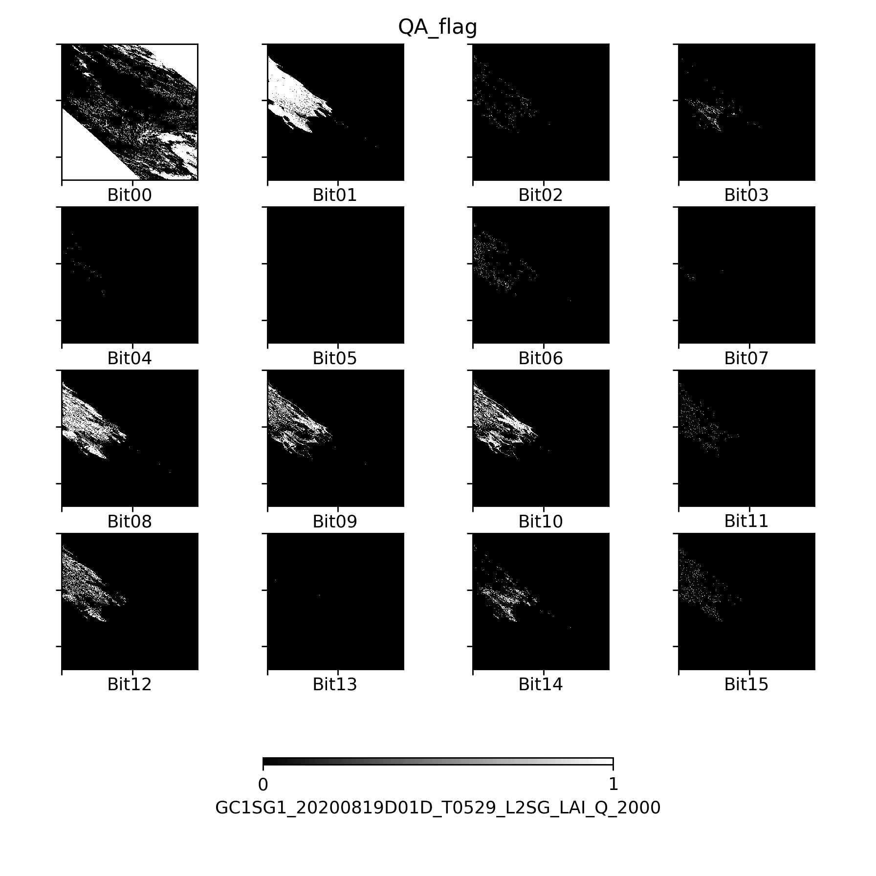
- ・Modified QA flag
Update contents of Ver.3
- ・Modified estimation algorithm, LUT, and parameters
- ・Changed input data (previous RSRFQ data are not used)
- ・Changed base map to SGLI forest structure map
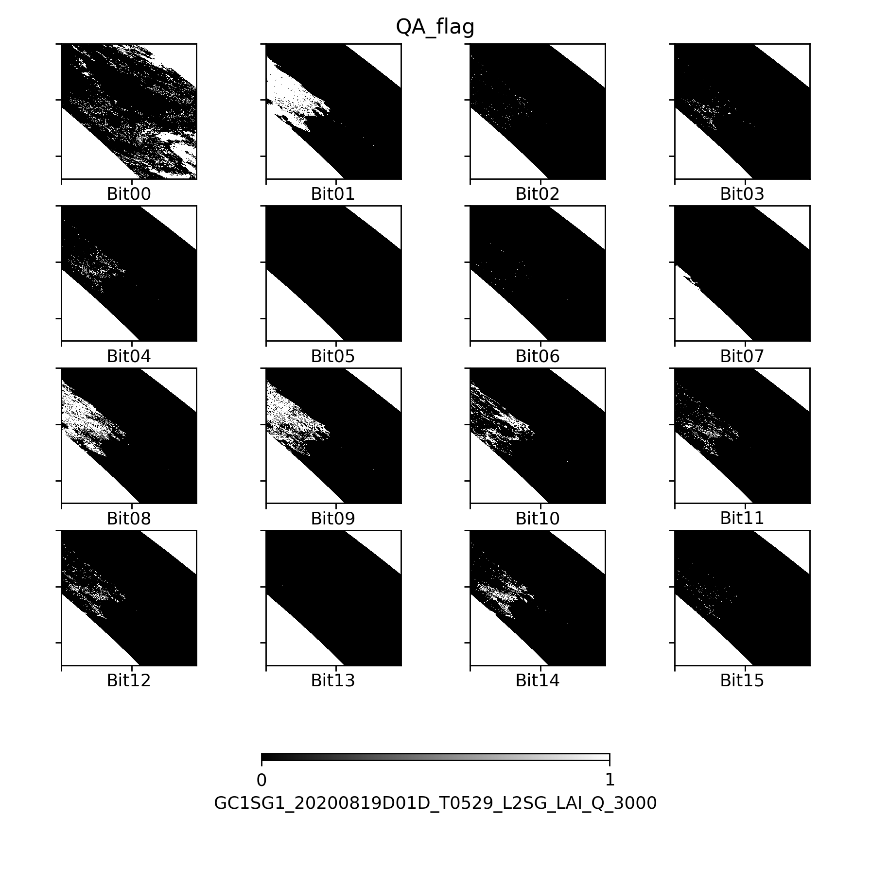
- ・Modified QA_flag
- ・Modified Mask_for_statistics
Sample image
| File format | Ver.1 | Ver.2 | Ver.3 |
|---|---|---|---|
| hdf5 |
TBU |
LAI_Q(250m) |
LAI_Q(250m) |
| Image |
TBU |
LAI(250m) Overstory_LAI(250m) FAPAR(250m) |
LAI(250m) Overstory_LAI(250m) FAPAR(250m) |
Dataset name
| Ver.1 | Description |
|---|---|
| FAPAR | Fraction of Absorbed Photosynthetically Active Radiation |
| LAI | Leaf Area Index |
| QA_flag | |
| Understory_NDVI | Normalized Difference Vegetation Index |
| Ver.2,3 | Description |
|---|---|
| FAPAR | Fraction of Absorbed Photosynthetically Active Radiation |
| LAI | Leaf Area Index |
| QA_flag | |
| Overstory_LAI | Leaf Area Index |
QA_flag information
Ver.1 Ver.2 Ver.3 Ver.1(Sample Image) Ver.2(Sample Image) Ver.3(Sample Image)
| Bit | ver1 | Description | FAPAR_L3_mask* | LAI_L3_mask* | Understory_NDVI_L3_mask* |
|---|---|---|---|---|---|
| 0 | no data | 1: any of used bands are error | 1 | 1 | 1 |
| 1 | land/water | 0: water >50%, 1: land > 50% | 0 | 0 | 0 |
| 2 | mixed with land/water | 1: land and water > 1% | 0 | 0 | 0 |
| 3 | cloud | 1: cloud | 1 | 1 | 1 |
| 4 | probably cloud | 1: probably cloud | 0 | 0 | 0 |
| 5 | snow or ice | 1: snow or ice | 0 | 0 | 0 |
| 6 | cloud shadow | 1: shadow | 0 | 0 | 0 |
| 7 | The condition of sensor zenith angle is not good | 1: vzan>40 or vzas < 40 | 0 | 0 | 0 |
| 8 | land cover type | land cover type for used LUT | 0 | 0 | 0 |
| 9 | land cover type | land cover type for used LUT | 0 | 0 | 0 |
| 10 | land cover type | land cover type for used LUT | 0 | 0 | 0 |
| 11 | quality level | quality | 0 | 0 | 0 |
| 12 | quality level | quality | 0 | 0 | 0 |
| 13 | Value could not be retrieved | 1: LAI/FAPAR could not be retrieved | 0 | 0 | 0 |
| 14 | unavailability of understory NDVI | 1: fixed value was assigned for understory NDVI | 0 | 0 | 0 |
| 15 | backup algorithm | 1: backup algorithm was applied | 0 | 0 | 0 |
* Bits masked by statistical processing are indicated by 1.
Please refer to here to the detail information for QA flag.
| Bit | ver2 | Description | FAPAR_L3_mask* | LAI_L3_mask* | Overstory_LAI_L3_mask* |
|---|---|---|---|---|---|
| 0 | no data | 1: any of used bands are error | 1 | 1 | 1 |
| 1 | land/water | 0: water >50%, 1: land > 50% | 0 | 0 | 0 |
| 2 | mixed with land/water | 1: land and water > 1% | 0 | 0 | 0 |
| 3 | cloud | 1: cloud | 1 | 1 | 1 |
| 4 | probably cloud | 1: probably cloud | 0 | 0 | 0 |
| 5 | snow or ice | 1: snow or ice | 0 | 0 | 0 |
| 6 | cloud shadow | 1: shadow | 1 | 1 | 1 |
| 7 | The condition of sensor zenith angle is not good | 1: vzan>40 or vzas < 40 | 1 | 1 | 1 |
| 8 | land cover type | land cover type for used LUT | 0 | 0 | 0 |
| 9 | land cover type | land cover type for used LUT | 0 | 0 | 0 |
| 10 | land cover type | land cover type for used LUT | 0 | 0 | 0 |
| 11 | quality level | quality | 0 | 0 | 0 |
| 12 | quality level | quality | 0 | 0 | 0 |
| 13 | Value could not be retrieved | 1: LAI/FAPAR could not be retrieved | 0 | 0 | 0 |
| 14 | pol cloud or high-tau | 1: pol cloud/high-tau | 1 | 1 | 1 |
| 15 | backup algorithm | 1: backup algorithm was applied | 1 | 1 | 1 |
* Bits masked by statistical processing are indicated by 1.
Please refer to here to the detail information for QA flag.
| Bit | ver2 | Description | FAPAR_L3_mask* | LAI_L3_mask* | Overstory_LAI_L3_mask* |
|---|---|---|---|---|---|
| 0 | no data | 1: any of used bands are error | 1 | 1 | 1 |
| 1 | land/water | 0: water >50%, 1: land > 50% | 0 | 0 | 0 |
| 2 | mixed with land/water | 1: land and water > 1% | 0 | 0 | 0 |
| 3 | cloud | 1: cloud | 1 | 1 | 1 |
| 4 | bad air condition | 1: bad air condition | 0 | 0 | 0 |
| 5 | snow or ice | 1: snow or ice | 0 | 0 | 0 |
| 6 | cloud shadow | 1: shadow | 1 | 1 | 1 |
| 7 | The condition of sensor zenith angle is not good | 1: vzan>40 or vzas < 40 | 1 | 1 | 1 |
| 8 | land cover type | land cover type for used LUT | 0 | 0 | 0 |
| 9 | land cover type | land cover type for used LUT | 0 | 0 | 0 |
| 10 | land cover type | land cover type for used LUT | 0 | 0 | 0 |
| 11 | quality level | 00:good, 10:acceptance, 01:unreliable, 11:poor | 0 | 0 | 0 |
| 12 | 0 | 0 | 0 | ||
| 13 | Value could not be retrieved | 1: LAI/FAPAR could not be retrieved | 0 | 0 | 0 |
| 14 | pol cloud or high-tau | 1: pol cloud/high-tau | 0 | 0 | 0 |
| 15 | backup algorithm | 1: backup algorithm was applied | 1 | 1 | 1 |
* 1は統計処理時にマスクされるBitを意味します。
QA_flagについてはこちらをご参照ください。
*Download:QA_flag(Ver.1)


Attribute information
How to use
- ・Physical quantity=DN*slope + offset
- ・Valid values are during Minimum_valid_DN~Maximum_valid_DN

