陸上エアロゾル(偏光)(ARPL)
概要
| ARPL | 定義 | 偏光観測を用いて推定したエアロゾル光学的厚さ(τ)及びオングストローム指数 |
| 単位 | 無次元 | |
| ATBD |
Ver.1 (Nov. 2018) Ver.2 (2020) |
Ver2での変更点
- ・偏光バンドを用いた雲スクリーニング機能追加
- ・積雪域スクリーニング(雲フラグプロダクト参照)
- ・QAフラグ変更
Ver.3での変更点
- ・廃止(ARNPへ統合)
格納物理量
| Ver1,2 | Description |
|---|---|
| ARAE_pol_land | Aerosol_Angstrom_Exponent at 670 nm and 860 nm |
| AROT_pol_land | Aerosol_Optical_Thickness at 670 nm |
| ARSSA_pol_land | Single_Scattering_Albedo at 380 nm |
| QA_flag |
QA_flag情報
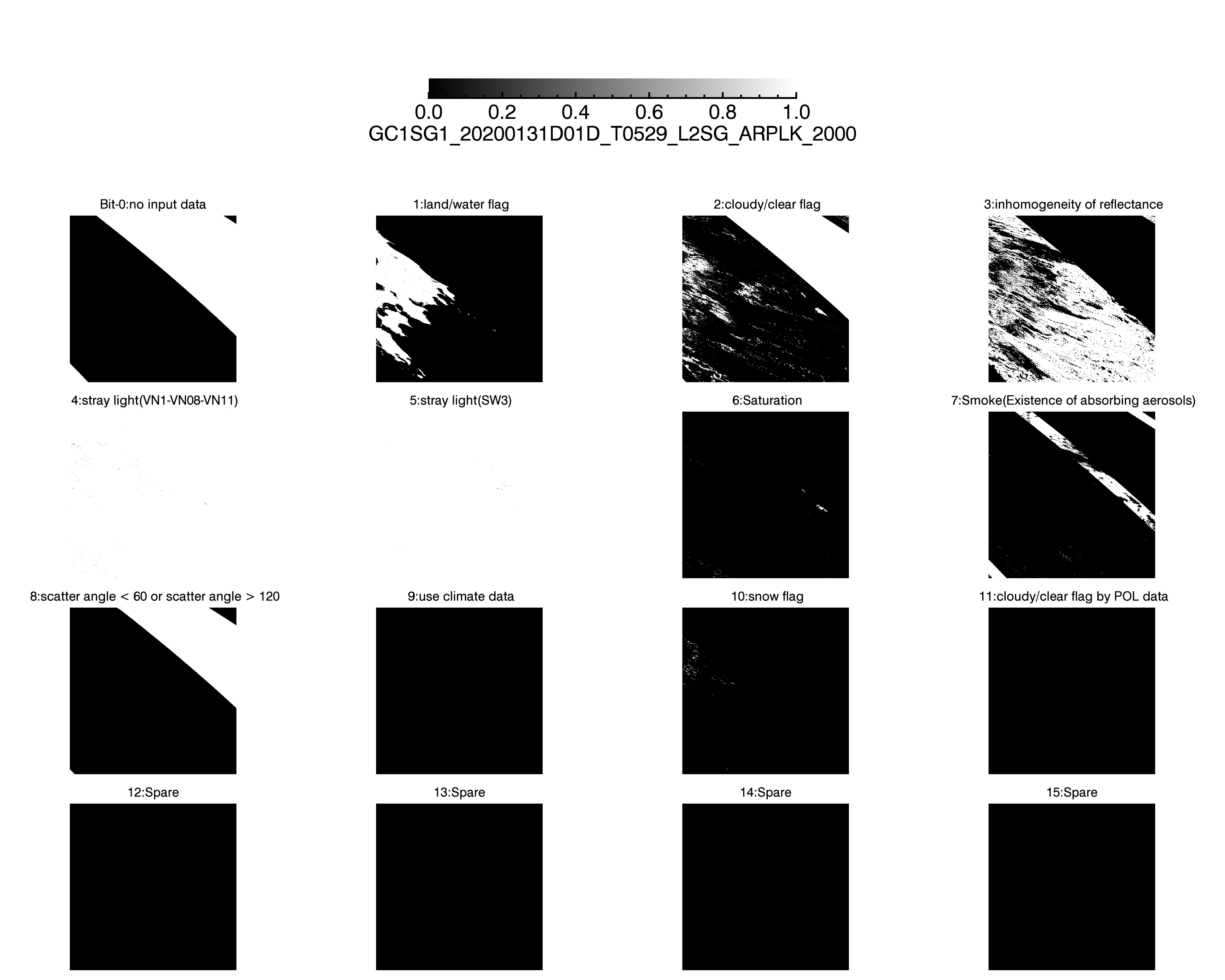
Ver.1 Ver.2 Ver.1(Sample Image) Ver.2(Sample Image)
*Sample Image:QA_flag(Ver1)
| Bit | ver1 | Description | ARAE_pol_land_L3_mask* | AROT_pol_land_L3_mask* | ARSSA_pol_land_L3_mask* |
|---|---|---|---|---|---|
| 0 | no input data | 0 = no/ 1 = yes | 1 | 1 | 1 |
| 1 | land/water flag | 0 = water/ 1= land | 0 | 0 | 0 |
| 2 | cloudy/clear flag | 0 = clear/ 1= cloud | 1 | 1 | 1 |
| 3 | inhomogeneity of reflectance | 0 = no/ 1 = yse | 1 | 1 | 1 |
| 4 | stray light (VN1,VN8,VN11) | 0 = no/ 1 = yes (at least one channel) | 0 | 0 | 0 |
| 5 | stray light (SW3) | 0 = no/ 1 = yes (at least one channel) | 0 | 0 | 0 |
| 6 | Saturation | 0 = no/ 1 = yes (at least one channel) | 0 | 0 | 0 |
| 7 | smoke(Existence of absorbing aerosols) | 0 = no/ 1 = yes | 0 | 0 | 0 |
| 8 | scatter angle < 60 or scatter angle > 120 | 0 = no/ 1 = yes | 0 | 0 | 0 |
| 9 | use climate data | 0 = no/ 1 = yes | 1 | 1 | 1 |
| 10 | TBD | 0 | 0 | 0 | |
| 11 | TBD | 0 | 0 | 0 | |
| 12 | TBD | 0 | 0 | 0 | |
| 13 | TBD | 0 | 0 | 0 | |
| 14 | TBD | 0 | 0 | 0 | |
| 15 | TBD | 0 | 0 | 0 |
* 1は統計処理時にマスクされるBitを意味します。
QA_flagについてはこちらをご参照ください。
*Sample Image:QA_flag(Ver2)
| Bit | ver2 | Description | ARAE_pol_land_L3_mask* | AROT_pol_land_L3_mask* | ARSSA_pol_land_L3_mask* |
|---|---|---|---|---|---|
| 0 | no input data | 0 = no/ 1 = yes | 1 | 1 | 1 |
| 1 | land/water flag | 0 = water/ 1= land | 0 | 0 | 0 |
| 2 | cloudy/clear flag | 0 = clear/ 1= cloud | 1 | 1 | 1 |
| 3 | inhomogeneity of reflectance | 0 = no/ 1 = yse | 1 | 1 | 1 |
| 4 | stray light (VN1,VN8,VN11) | 0 = no/ 1 = yes (at least one channel) | 0 | 0 | 0 |
| 5 | stray light (SW3) | 0 = no/ 1 = yes (at least one channel) | 0 | 0 | 0 |
| 6 | Saturation | 0 = no/ 1 = yes (at least one channel) | 0 | 0 | 0 |
| 7 | smoke(Existence of absorbing aerosols) | 0 = no/ 1 = yes | 0 | 0 | 0 |
| 8 | scatter angle < 60 or scatter angle > 120 | 0 = no/ 1 = yes | 0 | 0 | 0 |
| 9 | use climate data | 0 = no/ 1 = yes | 1 | 1 | 1 |
| 10 | snow flag | 0 = no/ 1 = yes | 1 | 1 | 1 |
| 11 | cloudy/clear flag by POL data | 0 = clear/ 1= cloud | 1 | 1 | 1 |
| 12 | TBD | 0 | 0 | 0 | |
| 13 | TBD | 0 | 0 | 0 | |
| 14 | TBD | 0 | 0 | 0 | |
| 15 | TBD | 0 | 0 | 0 |
* 1は統計処理時にマスクされるBitを意味します。
QA_flagについてはこちらをご参照ください。
*Download:QA_flag(Ver1)


*Download:QA_flag(Ver2)


Attribute情報
使い方
- ・物理量=DN*slope+offset
- ・有効値はMinimum_valid_DN~Maximum_valid_DN