- Ocean -
Sea Surface Temperature (GLI
Level 2 simulated using MODIS L1B)
Sea Surface Temperature derived by GLI SST algorithm (OTSK13) using
MODIS L1B data in 20 February 2001. 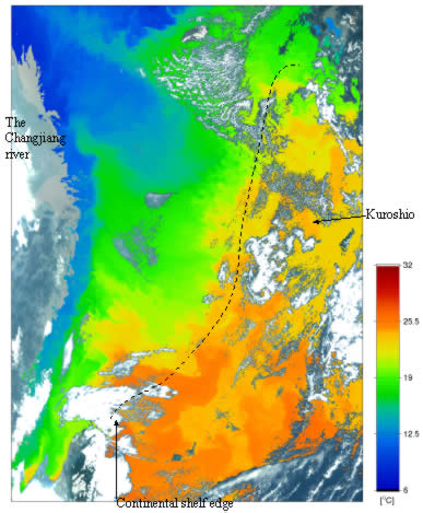
Land and cloud area are filled by RGB-image of satellite observed
radiances (at 625nm, 545nm and 490nm).
Upper left is the mouse of the Changjiang river. Kyusyu island is in
the upper right and Amami island is in the middle right.
This image show cold water from the Changjiang river, warm water from
the Kuroshio current, and their mixing along the continental shelf
edge. | 
