next gallery
previous gallery |
 |
- Land -
Land Monitoring by GLI
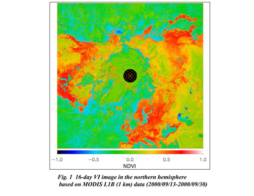
Vegetation can be monitored and the vegetation distribution in large areas can be observed with a vegetation index. This index utilizes the reflection of sunlight from trees and plants to quantify the vegetation density, seasonal changes of the vegetation, the effects of pest insects, and so on. A higher index value indicates greater vigour and amounts of vegetation.
GLI has 1-kilometer and 250-meter resolution channels. When we need more detailed spatial information than 1 km resolution sensors can obtain, 250 m resolution data can be acquired at the same place and time.
Figure 1 shows a GLI simulated image of the 1-km-resolution vegetation index of the northern hemisphere based on data collected by the MODIS sensor aboard the US Terra satellite. Figure 2 is a 250m-resolution natural color image, and Fig. 3 is a vegetation index image of apan. We will be able to calculate 1-km and 250-m-resolution vegetation index images from GLI data, enabling us to obtain vegetation information at two different resolutions simultaneously.

¡¡ |

