Aerosol by Polarization (ARPL)
Introduction
| ARPL | Def | Optical thickness, Angstrom exponent, and classification of aerosol estimated using polarization bands. |
| Unit | none | |
| ATBD |
Ver.1 (Nov. 2018) Ver.2 (2020) |
Update contents of Ver.2
- ・Improved the cloud identification using by polarization band
- ・Improved the snow/ice identification
- ・Modified QA flag
Update contents of Ver.3
- ・Abolished(merged into ARNP)
Dataset name
| Ver1,2 | Description |
|---|---|
| ARAE_pol_land | Aerosol_Angstrom_Exponent at 670 nm and 860 nm |
| AROT_pol_land | Aerosol_Optical_Thickness at 670 nm |
| ARSSA_pol_land | Single_Scattering_Albedo at 380 nm |
| QA_flag |
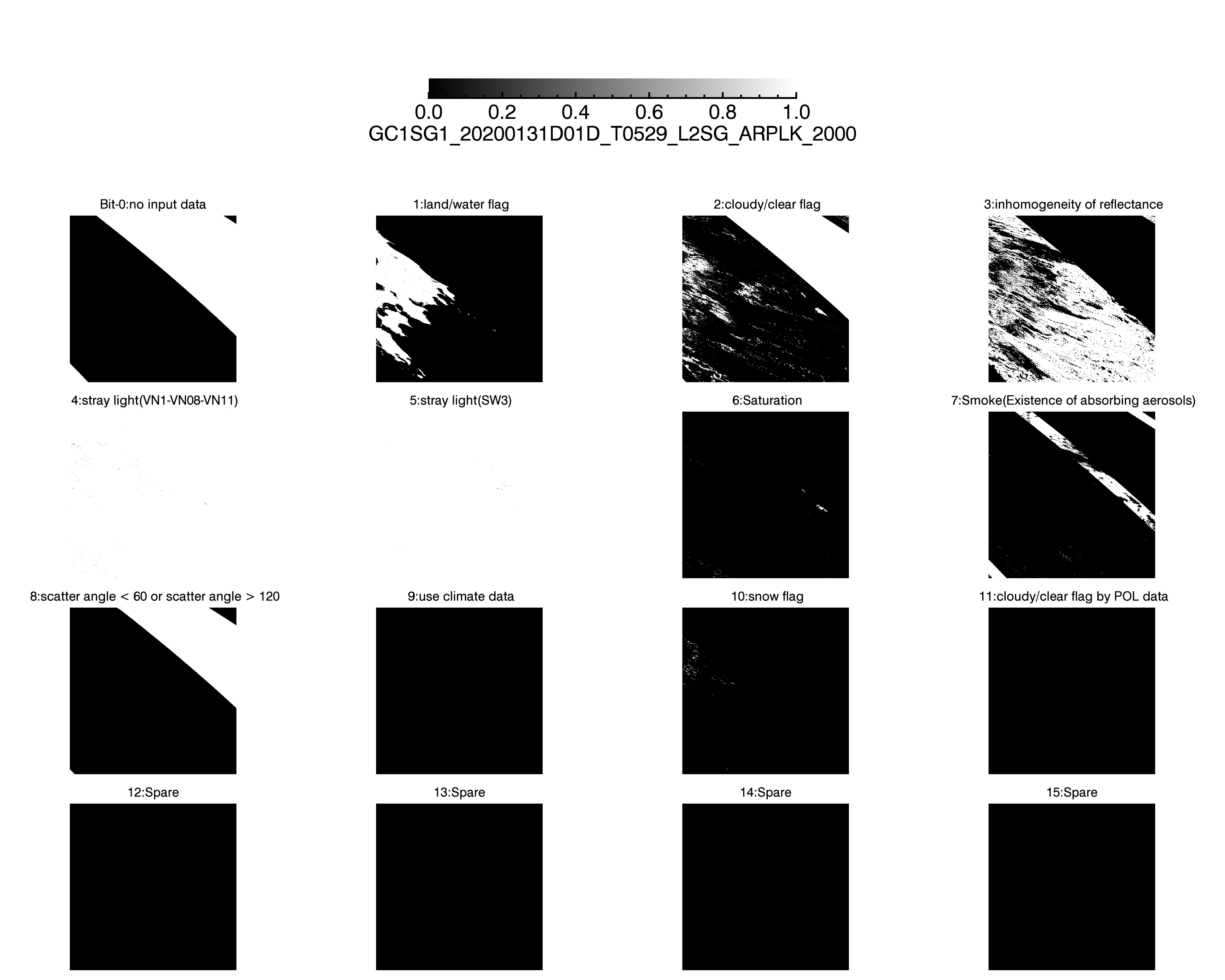
QA_flag information
Ver.1 Ver.2 Ver.1(Sample Image) Ver.2(Sample Image)
| Bit | ver1 | Description | ARAE_pol_land_L3_mask* | AROT_pol_land_L3_mask* | ARSSA_pol_land_L3_mask* |
|---|---|---|---|---|---|
| 0 | no input data | 0 = no/ 1 = yes | 1 | 1 | 1 |
| 1 | land/water flag | 0 = water/ 1= land | 0 | 0 | 0 |
| 2 | cloudy/clear flag | 0 = clear/ 1= cloud | 1 | 1 | 1 |
| 3 | inhomogeneity of reflectance | 0 = no/ 1 = yse | 1 | 1 | 1 |
| 4 | stray light (VN1,VN8,VN11) | 0 = no/ 1 = yes (at least one channel) | 0 | 0 | 0 |
| 5 | stray light (SW3) | 0 = no/ 1 = yes (at least one channel) | 0 | 0 | 0 |
| 6 | Saturation | 0 = no/ 1 = yes (at least one channel) | 0 | 0 | 0 |
| 7 | smoke(Existence of absorbing aerosols) | 0 = no/ 1 = yes | 0 | 0 | 0 |
| 8 | scatter angle < 60 or scatter angle > 120 | 0 = no/ 1 = yes | 0 | 0 | 0 |
| 9 | use climate data | 0 = no/ 1 = yes | 1 | 1 | 1 |
| 10 | TBD | 0 | 0 | 0 | |
| 11 | TBD | 0 | 0 | 0 | |
| 12 | TBD | 0 | 0 | 0 | |
| 13 | TBD | 0 | 0 | 0 | |
| 14 | TBD | 0 | 0 | 0 | |
| 15 | TBD | 0 | 0 | 0 |
* Bits masked by statistical processing are indicated by 1.
Please refer to here to the detail information for QA flag.
| Bit | ver2 | Description | ARAE_pol_land_L3_mask* | AROT_pol_land_L3_mask* | ARSSA_pol_land_L3_mask* |
|---|---|---|---|---|---|
| 0 | no input data | 0 = no/ 1 = yes | 1 | 1 | 1 |
| 1 | land/water flag | 0 = water/ 1= land | 0 | 0 | 0 |
| 2 | cloudy/clear flag | 0 = clear/ 1= cloud | 1 | 1 | 1 |
| 3 | inhomogeneity of reflectance | 0 = no/ 1 = yse | 1 | 1 | 1 |
| 4 | stray light (VN1,VN8,VN11) | 0 = no/ 1 = yes (at least one channel) | 0 | 0 | 0 |
| 5 | stray light (SW3) | 0 = no/ 1 = yes (at least one channel) | 0 | 0 | 0 |
| 6 | Saturation | 0 = no/ 1 = yes (at least one channel) | 0 | 0 | 0 |
| 7 | smoke(Existence of absorbing aerosols) | 0 = no/ 1 = yes | 0 | 0 | 0 |
| 8 | scatter angle < 60 or scatter angle > 120 | 0 = no/ 1 = yes | 0 | 0 | 0 |
| 9 | use climate data | 0 = no/ 1 = yes | 1 | 1 | 1 |
| 10 | snow flag | 0 = no/ 1 = yes | 1 | 1 | 1 |
| 11 | cloudy/clear flag by POL data | 0 = clear/ 1= cloud | 1 | 1 | 1 |
| 12 | TBD | 0 | 0 | 0 | |
| 13 | TBD | 0 | 0 | 0 | |
| 14 | TBD | 0 | 0 | 0 | |
| 15 | TBD | 0 | 0 | 0 |
* Bits masked by statistical processing are indicated by 1.
Please refer to here to the detail information for QA flag.
*Download:QA_flag(Ver1)


*Download:QA_flag(Ver2)


Attribute information
How to use
- ・Physical quantity=DN*slope + offset
- ・Valid values are during Minimum_valid_DN~Maximum_valid_DN